2578 x 3190 px | 21,8 x 27 cm | 8,6 x 10,6 inches | 300dpi
Aufnahmedatum:
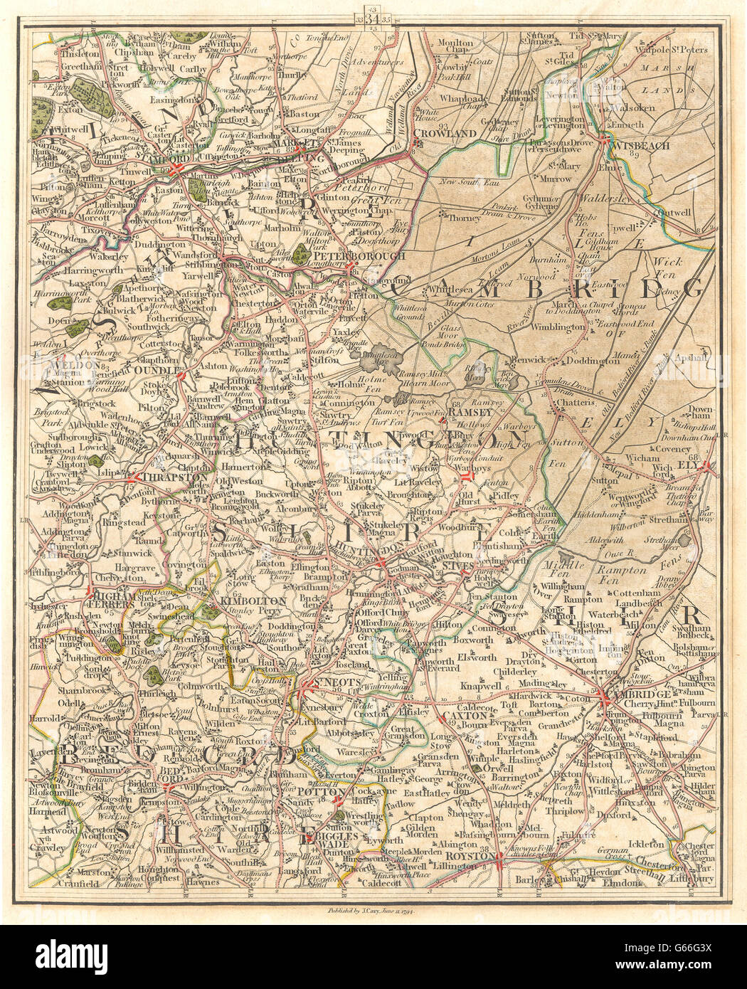
1794
Ort:
East Midlands
Weitere Informationen:
Dieses Bild kann kleinere Mängel aufweisen, da es sich um ein historisches Bild oder ein Reportagebild handel
'[no title]'. Artist/engraver/cartographer: J Cary. Provenance: "Cary's New Map of England and Wales, with part of Scotland"; Published by J. Cary, London. Type: Antique engraved map with original hand colouring. This antique map (section 34) includes all or part of the following places: Northamptonshire; Cambridge; Huntingdonshire; Bedfordshire; Crowland, Wisbeach, Peterborough, Weldon, Oundle, Thrapston, Ramsey, Ely, Huntingdon, St. Ives, Higham Ferrers, St. Neots, Cambridge Caxton, Bedford, Potton, Biggles Wade, Royston. Adjacent map sections are offered for sale separately: The map section to the North of this map is section number section 43. The map section to the South of this map is section number section 25. The map section to the East of this map is section number section 35. The map section to the West of this map is section number section 33.