3081 x 5039 px | 26,1 x 42,7 cm | 10,3 x 16,8 inches | 300dpi
Aufnahmedatum:
1806
Ort:
England
Weitere Informationen:
Dieses Bild kann kleinere Mängel aufweisen, da es sich um ein historisches Bild oder ein Reportagebild handel
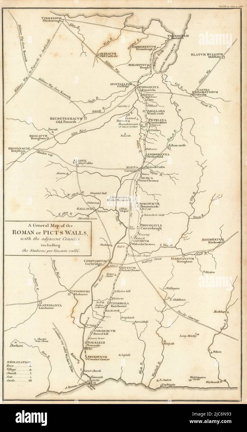
A General map of the Roman or Picts walls, with the adjacent country including the Stations per lineam valli. Artist/engraver/cartographer: Assumed to be John Cary. Provenance: "Britannia: or, a chorographical description of the flourishing kingdoms of England, Scotland and Ireland, and the islands adjacent; from the earliest antiquity", by William Camden. Translated from the edition published by the author in MDCVII. Enlarged by the latest discoveries, by Richard Gough. London: printed by John Nichols, for T. Payne and Son, Castle-Street, St. Martin's and G.G.J. and J. Robinson, Pater-Noster Row MDCCLXXXIX. Type: Antique copperplate map. The map shows Hadrian's Wall, with its milecastles and forts, between the Solway Firth and the Tyne. The Roman military roads and forts are shown